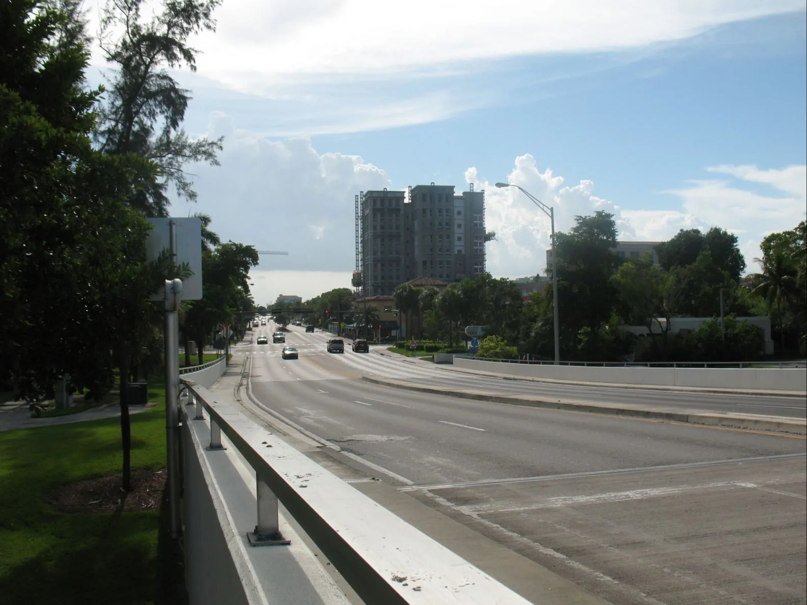
10 Boca Raton neighborhoods from Downtown to Woodfield Country Club: ZIP codes, zoned schools and 2026 grades, and August 2026 Zillow home values.
Last checked Oct. 8, 2026. Sources: the City of Boca Raton’s comprehensive plan, historic preservation page, city limits and address points; Palm Beach County’s subdivision plat layer; the School District of Palm Beach County’s attendance boundaries; the Florida Department of Education’s 2026 school grades; Zillow Research; the Census Bureau; and OpenStreetMap.
Boca Raton is a city of 100,234 people in southern Palm Beach County, according to the Census Bureau’s 2020-2024 American Community Survey, and covers about 30 square miles on the city’s map. It runs from the Atlantic Ocean west to Florida’s Turnpike at its northwest corner, and from the Broward County line in the south to Delray Beach and Highland Beach in the north. I-95 cuts through the middle on a diagonal, with five Boca Raton exits: 44 (Palmetto Park Road), 45 (Glades Road), 48A (Spanish River Boulevard/FAU Boulevard), 48B (Yamato Road) and 50 (Congress Avenue), according to FDOT’s exit list. The Turnpike’s only Boca Raton exit is 75, Glades Road.
Three things to know before you look at a listing:
- The mailing address is not the city. Some homes west of the city limit, in unincorporated Palm Beach County, have Boca Raton mailing addresses. Of about 45,900 addresses in the city’s own address data, none is in ZIP codes 33428 or 33498; those are Boca Raton mailing ZIP codes outside the city.
- Seven ZIP codes inside the city. Of those city addresses, 28% are in 33432, the downtown and beach side; 21% in 33431; 20% in 33486, west of downtown; 16% in 33487, the northeast; 8% in 33496, the northwest; and 4% and 3% in 33434 and 33433.
- Two high school zones, and they do not follow city limits. In the School District of Palm Beach County’s boundary layers, 74% of city addresses are zoned for Boca Raton Community High and 26% for Spanish River Community High. Both zones also reach into southern Delray Beach. Check one address with the district’s Find My School map.
How the city plans itself
The city’s Community Profile (PDF), part of its comprehensive plan, divides Boca Raton into five planning areas, each drawn around a center: Northwest (The Park at Broken Sound, the Boca Raton Innovation Campus and the Tri-Rail station), Northeast (North Boca Village and Federal Highway), Central (Florida Atlantic University and Boca Raton Regional Hospital), Southeast (Downtown Boca Raton and the Boca Raton Resort and Club) and Southwest (Town Center at Boca Raton and Boca Center). The plan says the boundaries were drawn to take in the homes around each center. The planning areas are large; the neighborhoods below are smaller places inside them that a county or city map names.
The areas at a glance
Home values are the Zillow Home Value Index for the ZIP code that holds most of each area, in August 2026. The index is a modeled typical value for the middle third of homes, not a sale price, and it covers the whole ZIP code.
| Area | ZIP code | Zoned high school | Typical home value, ZIP code | Guide |
|---|---|---|---|---|
| Downtown | 33432 | Boca Raton Community High | $1,069,242 | Downtown |
| Old Floresta | 33486 | Boca Raton Community High | $758,118 | Old Floresta |
| Royal Palm Yacht and Country Club | 33432 | Boca Raton Community High | $1,069,242 | Royal Palm Yacht and Country Club |
| Camino Gardens | 33486 | Boca Raton Community High | $758,118 | Camino Gardens |
| Boca Raton Square | 33486 | Boca Raton Community High | $758,118 | Boca Raton Square |
| Royal Oak Hills | 33486 | Boca Raton Community High | $758,118 | Royal Oak Hills |
| Country Club Village | 33486 | Boca Raton Community High | $758,118 | Country Club Village |
| Hidden Valley | 33487 | Boca Raton Community High | $681,732 | Hidden Valley |
| University Park | 33496 | Spanish River Community High | $1,053,347 | University Park |
| Woodfield Country Club | 33496 | Spanish River Community High | $1,053,347 | Woodfield Country Club |
Zillow’s figure for the city as a whole was $576,824, up 3.7% on the year. Boca Raton Community High earned an A with 73% of possible points in Florida’s 2026 grades and Spanish River an A with 81%, according to the Florida Department of Education. More in our home prices guide and schools guide.
Map of the areas
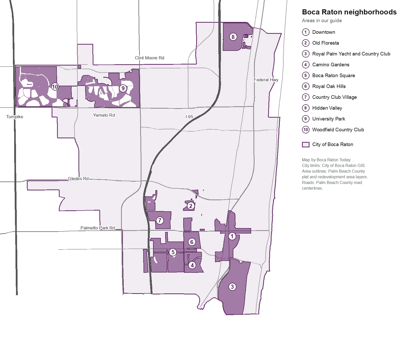
Map by Boca Raton Today. City limits from the City of Boca Raton; area outlines from Palm Beach County’s plat and community redevelopment area layers; roads from Palm Beach County’s road centerlines.
The areas
Downtown. The city’s redevelopment area, about 302 acres around Federal Highway and Palmetto Park Road, mostly condominiums, shops and offices, with Mizner Park, Memorial Park and the Brightline station.
Old Floresta. The Mediterranean Revival neighborhood Addison Mizner began in 1925, a city historic district since 1990, between Palmetto Park Road and Glades Road.
Royal Palm Yacht and Country Club. About 478 acres of single-family homes on canals and a golf course, east of Federal Highway and south of Camino Real.
Camino Gardens. About 420 single-family homes south of Camino Real, one of the neighborhoods in the city’s traffic calming program.
Boca Raton Square. The largest block of single-family homes in this guide, about 1,400, between I-95 and SW Ninth Avenue, with Addison Mizner School inside it.
Royal Oak Hills. About 120 acres of single-family homes between Palmetto Park Road and Camino Real, about a mile west of downtown.
Country Club Village. Homes and apartments between I-95 and NW 12th Avenue, next to Meadows Park, less than a mile by road from two I-95 exits.
Hidden Valley. About 630 single-family homes in the northeast corner between I-95 and Dixie Highway, zoned for Calusa Elementary.
University Park. The Arvida Country Club and Broken Sound plats north of Yamato Road between Jog Road and Military Trail, zoned for Spanish River Community High.
Woodfield Country Club. The largest area in this guide, about 553 acres between Florida’s Turnpike and Jog Road in the far northwest.
Two more named places: Mizner Park downtown, which has its own guide, and Pearl City, the city’s other historic district. According to the city’s design guidelines (PDF), Pearl City was platted on May 30, 1915, is Boca Raton’s oldest community and was designated a local historic district in 2002. It covers the original 15-acre parcel between what is now Glades Road and NE 10th Street.
How we built this
We named only areas a public source places on a map:
- Palm Beach County’s subdivision plat layer, which records the name every subdivision was filed under. We chose nine plat names or groups of names spread across the city and joined the sections that share a name (Hidden Valley sections 1 through 4, for example). Each area page says which plats it includes. Plat names in the city run to the hundreds; we did not name any that the county does not.
- The city’s own documents: the comprehensive plan’s planning areas, the historic districts on the historic preservation page, and the neighborhoods on the city’s traffic calming page.
- Palm Beach County’s community redevelopment area layer, for downtown.
- OpenStreetMap place names, which mark Royal Oak Hills, Old Floresta and University Park, among others.
- The city’s address points, about 45,900 inside the city, used for ZIP code shares, home counts and property types, matched on Oct. 8 to the School District of Palm Beach County’s boundary layers (elementary for 2026-27, middle and high for 2025-26). The district’s Find My School map is the final word on any address.
- Distances measured on the OpenStreetMap road network with the OSRM routing engine; bus routes from Palm Tran routes as mapped on OpenStreetMap; parks from the city’s parks layer; stores from OpenStreetMap, © OpenStreetMap contributors.
We do not rank areas. Every figure on these pages is from a named public source; if you see one that is out of date, tell us on our corrections page.
Related: schools, home prices, property taxes, getting around, moving here and Boca Raton vs. Deerfield Beach vs. Delray Beach vs. Lighthouse Point.
Frequently asked questions
What are the neighborhoods in Boca Raton, Florida?
Our guide covers 10 areas that a public map names: Downtown, Old Floresta, Royal Palm Yacht and Country Club, Camino Gardens, Boca Raton Square, Royal Oak Hills, Country Club Village, Hidden Valley, University Park and Woodfield Country Club. The city’s comprehensive plan also divides Boca Raton into five planning areas.
What ZIP codes are in Boca Raton city limits?
Seven. Of about 45,900 addresses in the city’s address data, 28% are in 33432, 21% in 33431, 20% in 33486, 16% in 33487, 8% in 33496, 4% in 33434 and 3% in 33433. Boca Raton mailing addresses in 33428 and 33498 are outside the city.
What high school is Boca Raton zoned for?
It depends on the address. In the School District of Palm Beach County’s boundary layers, 74% of the city’s addresses are zoned for Boca Raton Community High and 26% for Spanish River Community High. Both earned an A in Florida’s 2026 school grades.
Is a Boca Raton mailing address always in the city?
No. Some addresses west of the city, in unincorporated Palm Beach County, use Boca Raton as their mailing city. The Property Appraiser’s property search shows which city, if any, a parcel is in.
Have your say