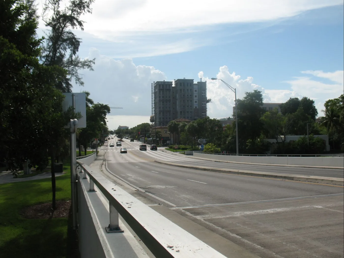
Federal Highway had 43 crashes that killed or seriously hurt someone in six years, the most in Boca Raton. The city's new plan aims for zero by 2050.
Boca Raton has a new plan to end traffic deaths and serious injuries on its streets by 2050. It names the 27 stretches of road where the worst crashes happen. Federal Highway tops the list.
The City Council adopted the Vision Zero Action Plan on Sept. 22, according to the city’s meeting recap. The same vote lets the city take up to $5.5 million in federal Safe Streets and Roads for All grants for safety projects.
The plan is built on six years of the city’s crash records, from 2018 through 2023. It is attached to Resolution 116-2026, and every figure in this story comes from it.
What the crash records show
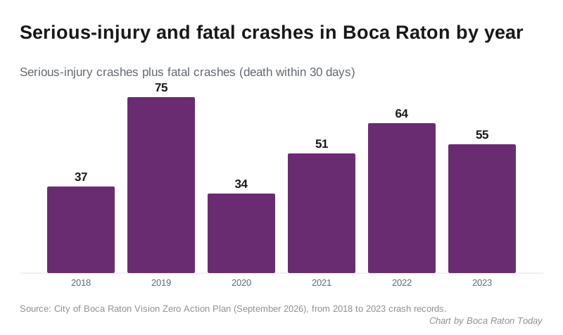
Over those six years, Boca Raton averaged seven crashes a day. It averaged four crashes a month that killed someone or left them seriously hurt.
- 16,138 crashes in all, from 1,761 in 2020 to 3,427 in 2019
- 272 crashes with a serious injury
- 44 fatal crashes, counting deaths within 30 days
- 13 fatal crashes in 2021, the worst year
The plan says those severe crashes were 2% of all crashes but 55% of their economic cost. It puts that cost at about $965 million over six years, or about $441,000 a day.
Speed is the pattern. Nearly half of the city’s fatal crashes, 48%, were on roads posted at 45 mph or more. Another 25% were on 40 mph roads.
The roads at the top of the list
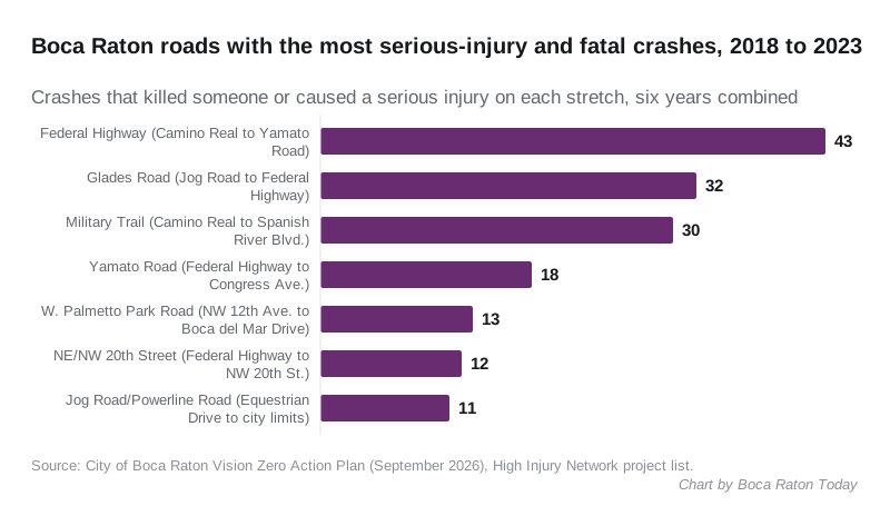
The plan maps a “High Injury Network” of the roads with the most and the worst crashes. These seven stretches had the most crashes that killed or seriously injured someone from 2018 to 2023:
| Road | Stretch | Miles | All crashes | Fatal or serious |
|---|---|---|---|---|
| Federal Highway (U.S. 1) | Camino Real to Yamato Road | 3.9 | 1,541 | 43 |
| Glades Road | Jog Road to Federal Highway | 4.0 | 2,454 | 32 |
| Military Trail | Camino Real to Spanish River Boulevard | 3.2 | 1,095 | 30 |
| Yamato Road | Federal Highway to Congress Avenue | 1.6 | 980 | 18 |
| West Palmetto Park Road | Northwest 12th Avenue to Boca del Mar Drive | 1.7 | 1,011 | 13 |
| Northeast and Northwest 20th Street | Federal Highway to Northwest 20th Street | 1.1 | 439 | 12 |
| Jog Road and Powerline Road | Equestrian Drive to the city limits | 2.0 | 452 | 11 |
Most of the worst roads are not the city’s to fix. Federal Highway, Glades Road and Yamato Road belong to the Florida Department of Transportation (FDOT). Military Trail, western Palmetto Park Road and Jog Road are Palm Beach County roads.
The plan says FDOT roads are 36% of the High Injury Network but had 49% of its serious-injury and fatal crashes. City-owned streets are 26% of the network and had nearly 30%. The city’s main corridors on the list include St. Andrews Boulevard, Northwest 19th Street, 20th Street, Spanish River Boulevard, Northwest 2nd Avenue and East Palmetto Park Road.
What the city plans to do
The plan recommends:
- 27 corridor projects
- improvements at 63 intersections
- five citywide policies and five programs
- a capital improvement program aimed at road safety
- closing gaps in the sidewalk and bike network
For the roads themselves, it lists slower design speeds and traffic calming, protected bike lanes and wider sidewalks, and fewer driveways. At intersections it proposes turn lanes, roundabouts, refuge islands, better crosswalks and signals that give people on foot a head start. Because signals are far apart on the big state roads, it also suggests mid-block crossing signals.
The plan calls its proposals “starting points” that may change with further study. It says the city will work with FDOT and Palm Beach County on the roads they own.
The money
The city has two federal grants to spend on safety projects over the next six years, according to a Sept. 2 memo from City Manager Mark Sohaney.
| Grant | Federal share | City match | Total |
|---|---|---|---|
| Fiscal 2024 Safe Streets and Roads for All | up to $4 million | $1 million | $5 million |
| Fiscal 2025 Safe Streets and Roads for All | up to $1.5 million | $500,000 | $2 million |
The memo says the money will pay for more safety analysis and “demonstration” projects, built in phases. Adopting the plan itself costs nothing extra, the memo says. An earlier federal grant paid for writing it.
The council first named Boca Raton a “Vision Zero City” in October 2022. About 69 people came to public meetings on the plan. Another 332 filled out an online survey and dropped 1,054 pins on a map of problem spots. The main complaints were aggressive and distracted driving, speeding, red-light running and roads that feel unsafe to walk or bike along.
What it means for you
- No road changes yet. The plan names the problem roads and the kinds of fixes. Each project still has to be designed and paid for, and the state and county roads need FDOT and Palm Beach County to agree.
- Federal Highway is already changing. FDOT’s rebuild of U.S. 1 through downtown adds separated bike lanes and wider sidewalks, with work running into fall 2027. Our road construction and closures guide has the current lane closures.
- You can report a dangerous spot. Call the city’s Traffic Division at 561-416-3372 about a broken signal or a problem intersection. Our who to call at City Hall page lists other city contacts.
- Read the plan. The full plan, with a summary sheet for every corridor and intersection, is in the resolution file, part 1 and part 2.
Have your say